
Key Facts
- Location: Guangzhou
- Time Period: 2005 – 2006
- Site Area: approx. 17.5 ha
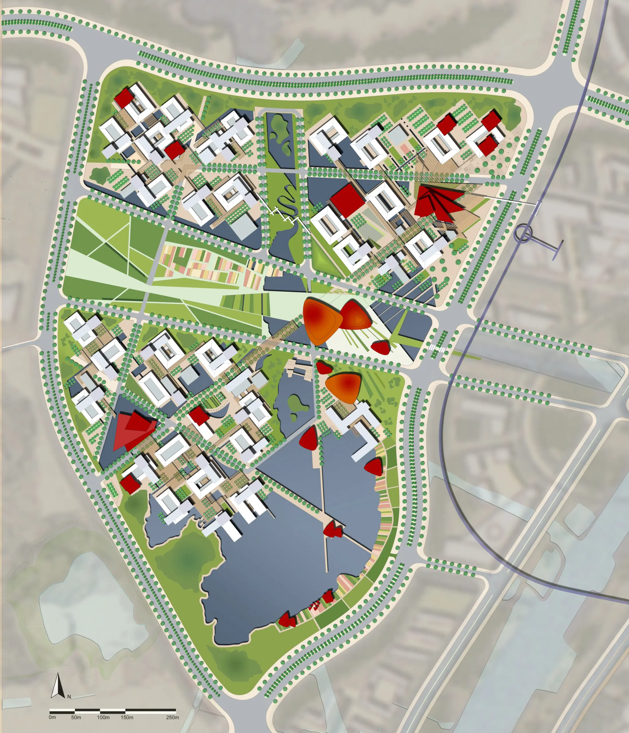
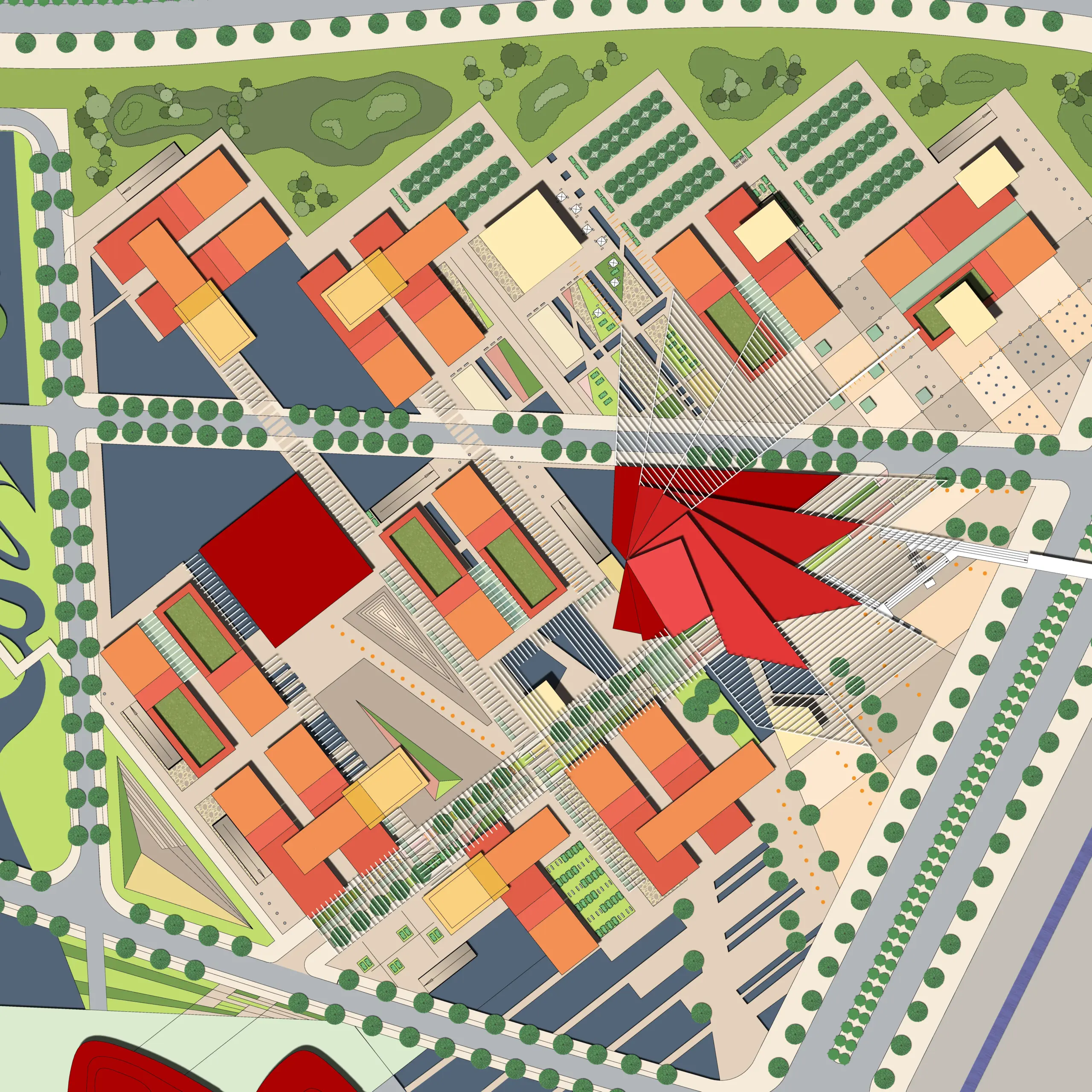
As part of the Guangzhou-Nansha urban development plan, an urban design concept was to be developed for the Nansha district.
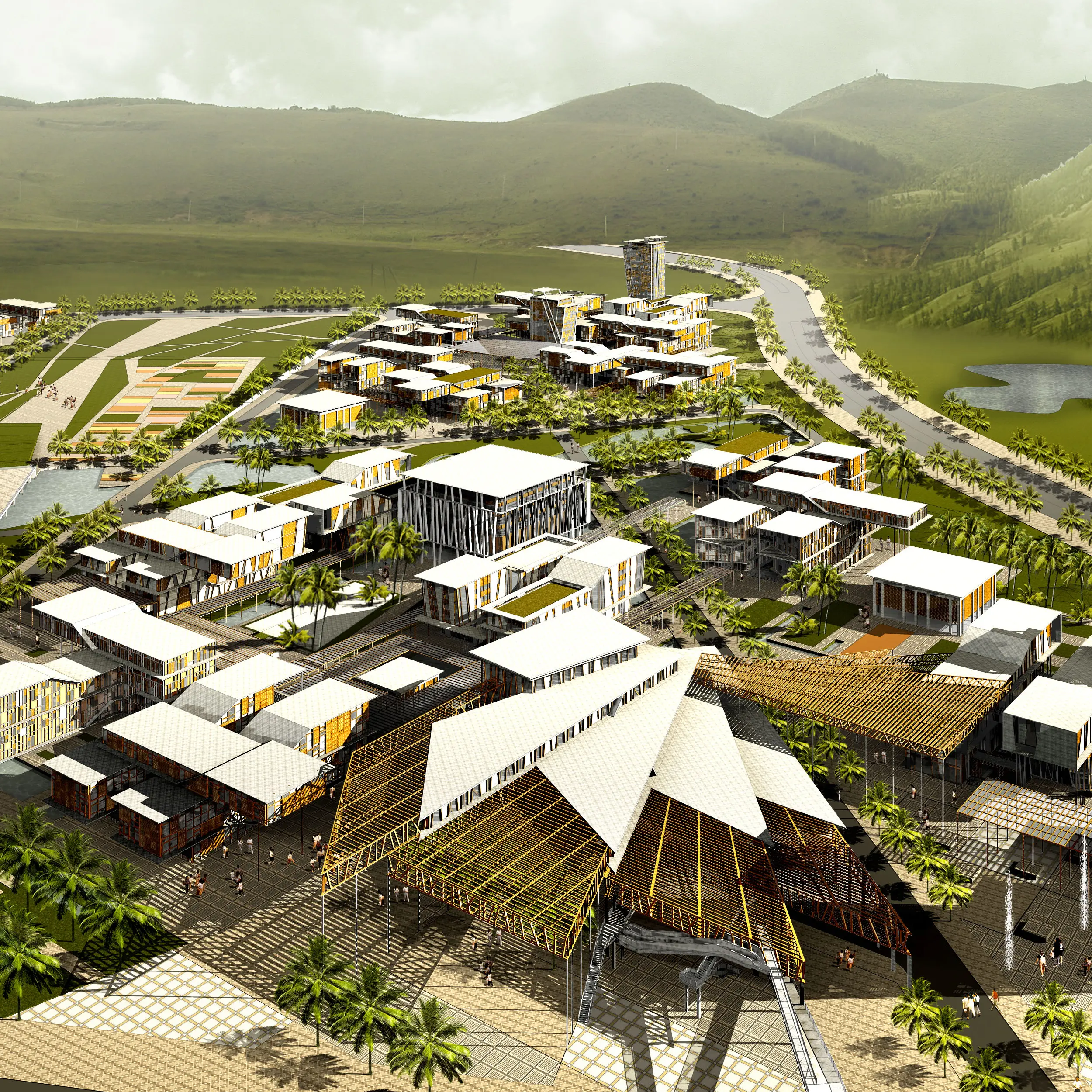
The project involves the creation of an administrative center representing a mix of work, education, housing, and recreation. The master plan incorporates the high-quality natural setting between the mountains and the river, seeking to enhance it through the generous landscaping of a green corridor featuring water, topography, and vegetation.
The fundamental idea is the development of a novel form of government through spatially networked building structures with high variability in the shape, height, and width of individual buildings, which are interconnected by public covered paths, squares, and courtyards. These attractive connecting axes serve to facilitate communication between the buildings.
The objective was the urban and architectural representation of a modern form of government that is equally committed to the climate, ecology, culture, and history of Nansha.


